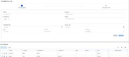
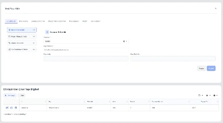
New Project Definition
Initial information for urban transformation projects is created on this screen. Project name, code, location, start-end dates and responsible teams are defined for systematic project management.


GIS-based urban transformation platform for integrated management of project areas and spatial data.

Urban transformation project areas, buildings, parcels, cadastral and address data are displayed and managed on a GIS-based map.

Supports vector data formats such as SHP, KML, GeoJSON, GML, WKT and DXF.
Right ownership, valuation, building inventory, ownership distribution and project-based analyses are dynamically generated and exportable.

Fully integrated with TAKBIS, MERNIS and municipal information systems; supports PostgreSQL/PostGIS infrastructure.

Ensures process management in accordance with Law No. 6306 and related regulations.
The Urban Transformation Software is a web-based, GIS-integrated automation system developed to manage all processes related to urban transformation projects carried out by municipalities, including risky areas and reserve building zones, within a single platform.
The system enables end-to-end digital management of project area definition via map interface, building and independent unit inventory creation, ownership and title deed association, valuation calculations, right ownership processes, and contract management.
With multi-project management, dynamic reporting, Excel and data export, role-based authorization, and transaction/time logging, the system builds institutional memory and strengthens decision-support mechanisms throughout the transformation process.

Initial information for urban transformation projects is created on this screen. Project name, code, location, start-end dates and responsible teams are defined for systematic project management.
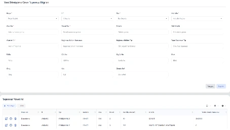
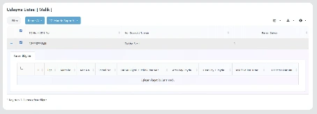
This screen is used to register title deed and technical information of parcels and independent units included in the transformation project. Province, district, neighborhood, area size and property type details are defined to create a centralized project inventory.
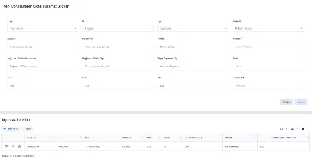
This screen is used to record parcels and independent units removed from the transformation project. Title deed and technical data of excluded properties are updated to ensure inventory consistency and process traceability.
This screen is used to register the new structure that will replace the existing building within the urban transformation process. Users define province, district, neighborhood, block, parcel, total area and construction year information.
This screen is used to enter location, identity and technical details of newly constructed buildings. Project/license data, area and volume details, classifications, independent units and building documents are managed in a tab-based interface.
This screen manages compensation offers and reconciliation processes with property owners. Owner details and associated parcels are displayed, offered amounts are recorded, and reconciliation status and reports can be monitored.
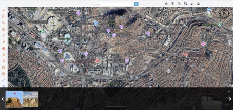
All properties, buildings and parcels related to urban transformation projects are displayed and managed on a map-based interface. Layer management, spatial querying, drawing, measurement and data filtering support detailed analysis and decision-making.
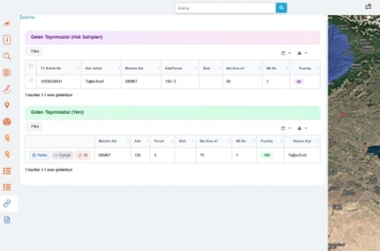
The system compares and matches pre-transformation and post-transformation properties through a map-based interface. Matching, scoring and allocation processes are supported to ensure a transparent and traceable distribution workflow.