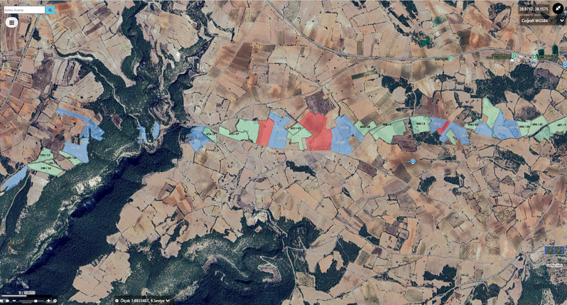
Track Expropriation Steps on the Map
Stages resulting from transactions on properties are tracked on the map.


A system that manages expropriation and land acquisition processes on a single GIS-based platform.

Enables viewing all properties in expropriation areas on a GIS-based map along with boundary and project information.

Supports formats such as DGN, DWG, DXF, GML, KML, KMZ, NCZ, TAB, and SHP.
All processes related to valuation, settlement, lawsuits, payments, and registration can be reported through the system.

Works fully integrated with TAKBIS, MERNIS, VEDOP, EBYS, and e-signature services.

Complies with the Expropriation Law No. 2942 and related regulations.
OdakKYP is a geospatial web software that enables expropriation, urgent expropriation, and land acquisition processes to be carried out digitally.
The system consolidates all project steps—from planning to property identification, valuation, notification, settlement, litigation, and registration—in a single platform.
This system has been shown to reduce the workload of expropriation units, preserve data integrity, and ensure transparent tracking of processes.
GIS infrastructure enables the display of each property on the map, with project boundaries and kilometer markers clearly marked.
All documents are prepared electronically, approved with e-signature, and automatically archived in the institution's records.

Stages resulting from transactions on properties are tracked on the map.
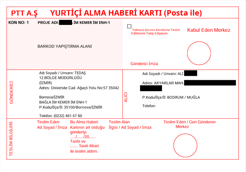
Meeting planning, notification creation, postcard and label creation in a single screen.

Quick access to statistics such as Project, Property, Owner, Settlement, Lawsuit, Payment, etc.
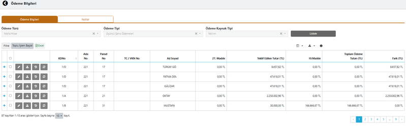
Project, parcel, and share/owner payments are managed through the application; the Article 27 and Offer Amount / Article 10 difference is calculated automatically.
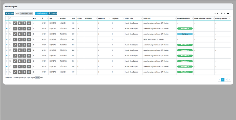
Article 10 and Article 27 lawsuits are created in compliance with regulations and their status is tracked.
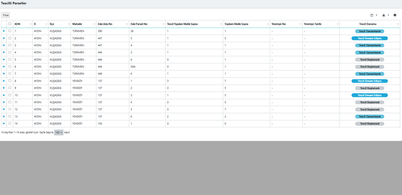
Property registration information is updated in bulk and tracked through the application.
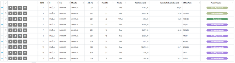
Parcel statuses change automatically based on actions and can be tracked.

If land registry integration exists, all area and owner information is automatically provided using only the project boundary. Without integration, planning is simplified using different digital formats.